Start by copy pasting the route in to another map applications to get a quick overview of where there are deviations. Focus on investigating these deviations, especially if they are ranking high on the “potential error list”. But be aware of situations where the difference is just from a different preference of route, some map applications just seem to prefer certain type of roads etc. If you do not recognize what is an obvious preference difference, you can end up doing a lot of unnecessary investigation where there is no real issue. Sometimes adding 1-2 extra stops can get around this issue and then compare like for like routes with less “normal” deviations.
Approach rating efficiently by evaluating the route and identifying the high-risk areas. Start by looking at these for an MNE. What are high risk areas?
Obviously, you should not rule out anything but spending time on these, instead of tracking the routing along a major road, especially rural ones, where perhaps two other map applications agree with the routing, is simply more effective way of evaluating the route.
Misalignments are considered MNEs when the misalignment is more than 50 meters from blue route line to the ’present day’ ground truth. It is very common for the blue route line to be misaligned along long stretches of the route. It is very important to scan thoroughly even the sections that follow major roads without turns. Often the misalignment is less than 50 meters, in which case it should be rated as a minor issue, but the misalignment distance should always be measured. If it is more than 50 meters, a comment and the coordinates are required. This is one type of misalignment. See the Guidelines section 4.1.1. for the definitions of the other types.
the start nor destination point of the route, it is marked as an MNE – Access Restricted, see 4.3.Access Restricted
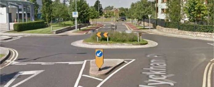
Turn restrictions are always indicated with traffic signs. Therefore any turns that can’t be confirmed by painted arrows/turn channels on satellite images, should be checked on street view, see 4.7.
Turn Restriction
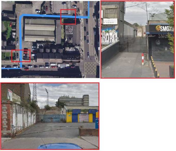
Many times the suggested route uses pedestrian/bicycle roads. Any suspicious sections should be checked on street view, as often the pedestrian areas seem wide enough for a car. For example in the screenshots below the pedestrian zones might seem like streets for cars on satellite image but street view images clearly have signs that indicate that these roads are only allowed for
pedestrians or cyclists, see 4.4.Cars Not Allowed
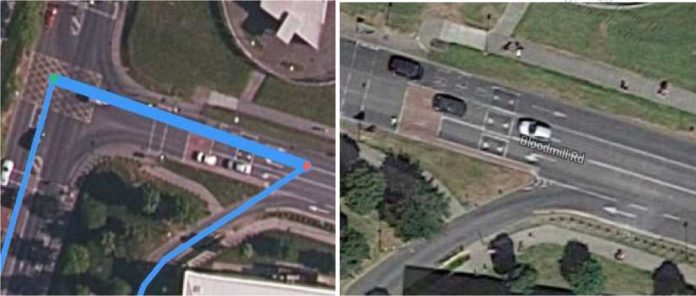
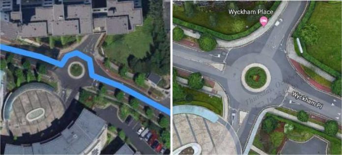
As you can see the below the blue line route instructs the user to go against the flow of traffic on the roundabout which is a MNE, see 4.1.1.2. Roundabouts and Traffic Circles
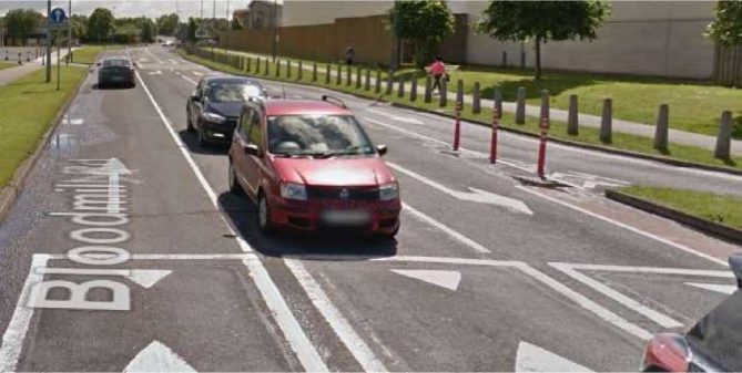
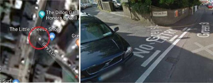
In the below example the route begins on a one way road but the route instructs the user to go the wrong way on this road. This is against traffic and so should be rated as a MNE.
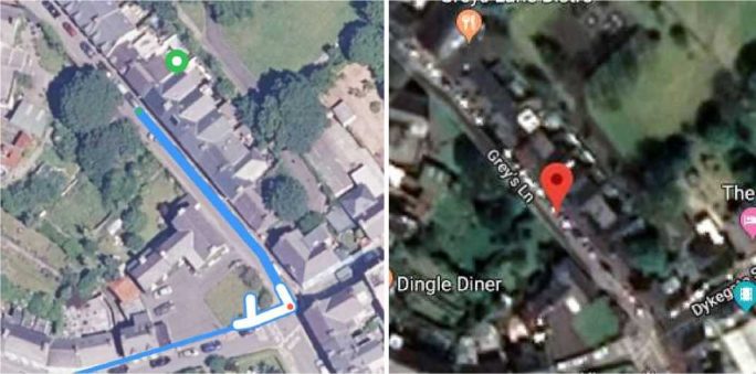
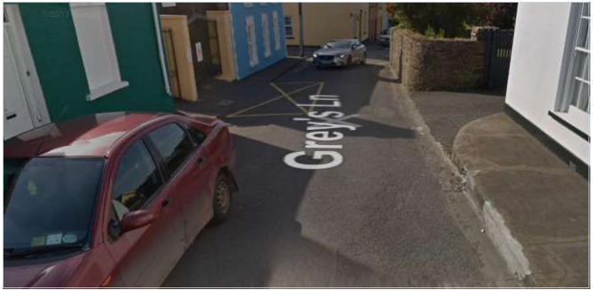
At the top of the road we can see that there is road markings indicating that traffic is not allowed down this road as the route direction suggests.
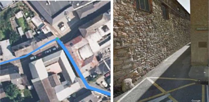
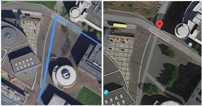
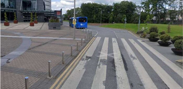
Below is an example where user is instructed to go over a barrier and onto a pedestrian walkway. This is thus an MNE – Physically Impossible on this route.
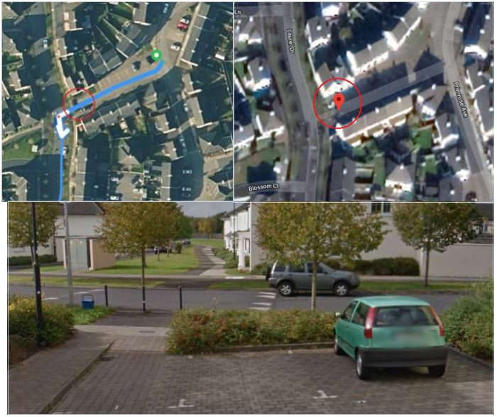
In this below example the route goes on a pedestrian path and over a divider where it’s not possible to drive. Again this is a physical impossibility and should be rated as a MNE.
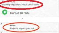
Some routes include a pedestrian part, which is indicated it in the instructions, so the route is rated normally. You’ll need to check the steps to see if they mention Prepare to Park or any other instruction related to Walking. Mainly in the cases where route takes user to where cars are not allowed.
MNE | Comment |
Major Road Misalignment | At Step N, 60.111111,24.222222, the route misses a roundabout larger than 50 m in diameter. [link to resource] At Step N, 60.111111,24.222222, the route misses a turn channel that measures more than 100 m from the beginning to the end of the turn channel divider. [link to resource] At Step N, 60.111111,24.222222, the route misses a turn channel, because there exists a point along the center of the turn channel lane, from which the distance to the closest point on the blue line is more than 50 m. [link to resource] |
Physically Impossible | At Step N, 60.111111,24.222222, the route uses a road that does not exist in the real world. [link to resource] At Step N, 60.111111,24.222222, the user is requested to make a manoeuvre which is no more possible because the road network has changed, as can be verified from more recent satellite images [link to resource]. |
Access Restricted | At Step N, 60.111111,24.222222, the route travels through an area restricted only to residents, as can be verified from street level images [link to resource]. Because the route does not start or end within the restricted area, this is an MNE. |
Cars Not Allowed | At Step N, 60.111111,24.222222, cars are not allowed to use the pedestrian only walkway indicated by the traffic sign visible in the street level images [link to resource]. |
Against Traffic | At Step N, 60.111111,24.222222, the route goes against traffic as there is a traffic sign forbidding driving this way, see the street imagery [link to resource]. |
Illegal U-Turn | At Step N, 60.111111,24.222222, it is illegal to make a U-turn on a motorway. [link to resource] At Step N, 60.111111,24.222222, there is a traffic sign, which prohibits U-turns, as can be verified from street imagery [link to resource]. |
Turn Restriction | At Step N, 60.111111,24.222222, it is not allowed to turn left between 6 – 18 hours any day of the week, as indicated by the traffic sign visible in the street level images [link to resource]. Since the user will reach this step during the time of restriction, this is an MNE. |
Other | At Step N, 60.111111,24.222222, [provide a detailed explanation what is wrong with the route]. [link to resource] |