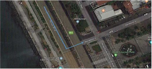
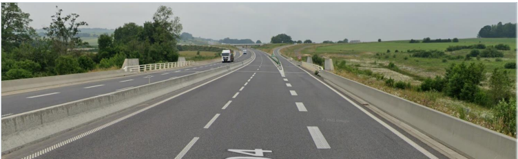
A Physically Impossible MNE should be selected when the route uses roads that do not exist in the real life or requires the driver to perform impossible driving maneuvers. Be aware of road dividers when they exist on a straight road. On the example below, indicating a turn from Roxas Blvd. to Remedios St. would be considered as an MNE – Physically Impossible.


X
Task route may suggest passing through an area where there is no road available. You will need to check this against other map portals to confirm if the . . . .
road exists or not. In the example below, the route suggests a right turn at
(16.423544, 120.622354).
Satellite View shows no road structure in this area. You can confirm that the task route instructs the user to make a turn on a non-existent road through available street imagery from other online maps portals.

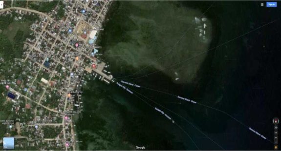
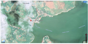
A route sometimes indicates a use of ferry. Be sure to check other maps to see the true layout of a ferry terminal. See if the route is entering/exiting ferries in the terminal and not indicating roads in the ocean.
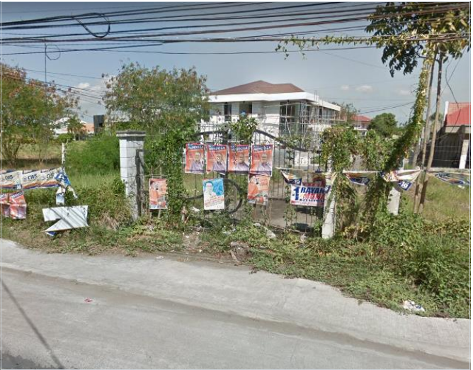
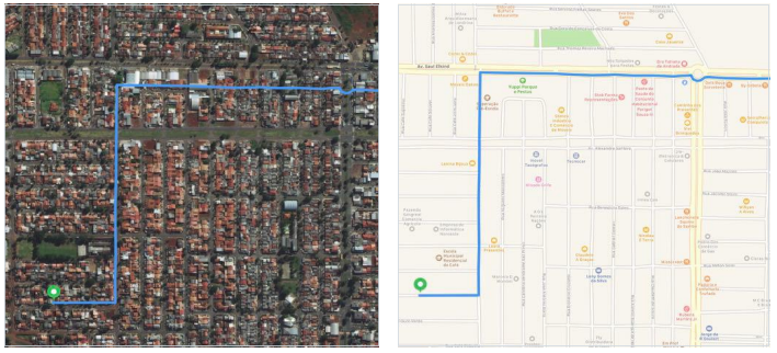
Task routes may sometimes start within a private community. With this, the task route should instruct the user to make a safe exit from this area.
In the example below with coordinates (13.64161, 123.20407), the route started from a private community but made an exit on an inactive gate. We can
see from available online street imagery that this gate is stale and unlikely to be passable by cars and pedestrians.
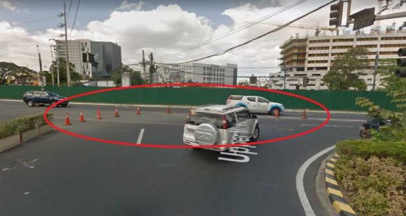
U-turns are not always allowed at divided intersections. Always look for possible No U-turn signs and check all possible placements. It should be facing the direction of the car. Sometimes it could be at the other side of the intersection. Please see the below example where the blue line suggests a U- turn at 14.525263,120.990393 where there is a clear No U-turn sign. This should be highlighted as an MNE illegal U-turn.

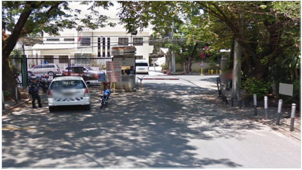
Route has Access Restricted error when a route passes a restricted area that is not their Starting Point or Ending Destination. The sample below shows a route that passes through a gated community – Ecology Village. Coordinates: (14.54215, 121.01912).
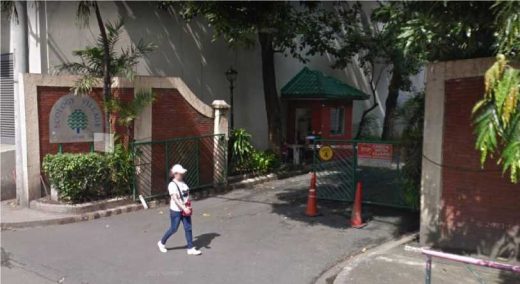
The second image shows the gate of the same village. It appears that the route made a shortcut through a private village when this is not the user’s end destination.
Route has not Access Restricted MNE when a route begins or ends in a restricted area. In this situation, the route requester is assumed to have access and it would not be considered an MNE.
An Access Restriction occurs when a route passes through a restricted access area or roads that are not allowed for public use. These areas include but are not limited to private subdivisions or villages, random private residential parking lots, parcels of a gas station, businesses’ parking lots and areas with signage of restriction.
Certain roads/streets also have access restrictions by specific time of day. This occurs when there is signage that shows that this road is accessible by specific time of the day. You should base your judgment on the expected time the user would arrive at the step based on the step lengths. If no initial route time is provided, no need to consider the access restriction.
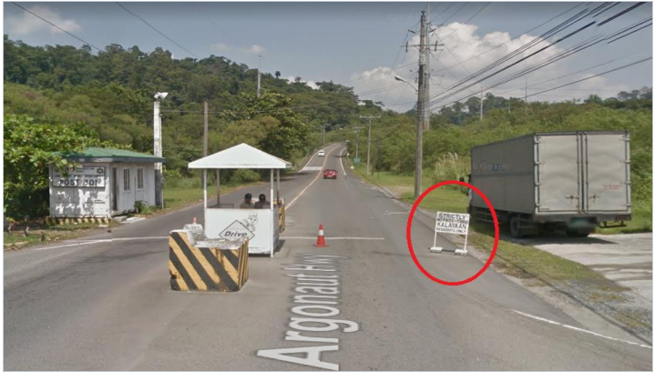
Example below shows a task route that instructs the user to pass through a road that is limited to private subdivision residence only. There is a signage in coordinates (14.82839, 120.30231) that shows “Strictly No Pass Thru.
Kalayaan Residents Only”. This private residence is not the user’s destination.
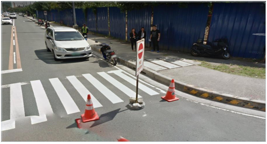
Against traffic errors should only be used in cases where a user following the blue line would think they are being instructed to drive the wrong way down a road. Against Traffic errors include but are not limited to illegal turn onto a oneway road, two-way road reduces to one-way road and misalignments with driving the wrong direction on a road.
Be sure to check the direction of traffic for every turn and entries onto other streets. In the example below, we can verify that this is a one-way road. All cars are going South.
A strong evidence of Against Traffic shows a signage “No Entry” near this road.
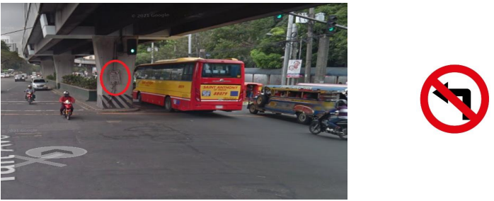
A turn restriction error should be indicated when the route has asked you to make a turn that is physically possible but prohibited by signage or other restrictions. These signages include but are not limited to No Left Turn and No Right Turn signages.
Be sure to check every turn in every step of the route by comparing with other online street imagery and satellite views.
If the task route instructs the user to make a left turn on a road with No Left Turn signage but there are visible cars taking a left turn via available street imagery, we should still give it a rating of Turn Restriction error since we are judging and following the legality of local traffic rules.
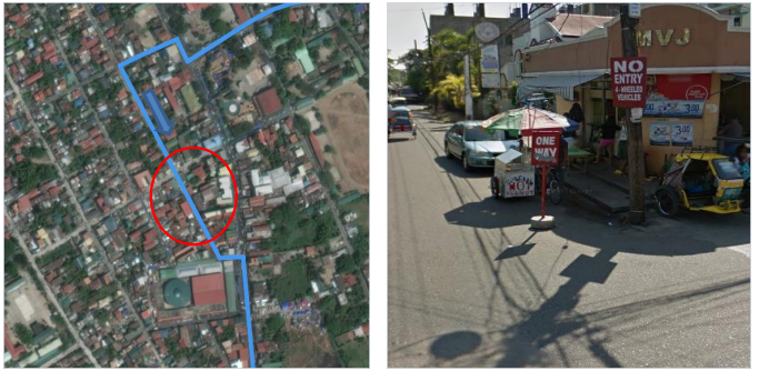
A Cars Not allowed error occurs when the route uses a road that does not allow for a usage of a typical car. Common examples of these are roads or pathways that are limited to buses, motorcycles, bicycles and pedestrians. You should look out for traffic sign boards that particularly say No 4-wheelers allowed. In this example below, the route suggests passing through a street that restricts entry for 4-wheelers. This can be confirmed from satellite imagery at 16.068661,120.40351.
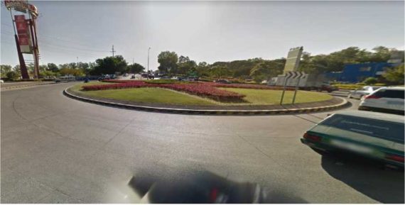
A route may sometimes indicate roundabouts that no longer exist. In this case, always check for the most current satellite and street imagery available when investigating. A 50m wide roundabout that exists only on the blue line would be
considered as an MNE.
Take a look at the sample below. This image is a stale previous street imagery.
 Take a look at the sample below. This image is a stale previous street imagery.
The image below is the latest street imagery for the same spot. It can be confirmed that the roundabout does not exist anymore.
It is important to understand the difference between minor misalignment and (whether they are caused by stylistic decisions or incorrect data) and Major road misalignments.
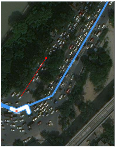
In the below example, the blue line seems to be entering the road that is against traffic 28.543757,77.310523, but this should not be rated as MNE. The blue line should have been 24m (less than 50) to the left to have been perfect. Since the misalignment is less than 50m, this should be considered as Minor misalignment.
Tip : Always use a tool to measure distances. Start measuring from the beginning of the turn channel and stop when the line become solid and make the turn illegal.
Sometimes Satellite and Standard layers are not aligned, and it might make it tricky to rate routes in those cases. Analyst is expected to always rate the route against real world, but needs to pay extra attention when odd misalignments, in some cases the whole route, is noticed. In those cases, use the Hybrid view and a comparison side by side of Standard and Satellite and other maps providers will make it clear if Satellite View is misaligned and the “fake” misalignment is not rated as an MNE.
When we look at the satellite view, it looks that a misalignment over 50 meters is happening, but when we check on Hybrid and Standard views, we can see that it is an issue with the layers, not with the route itself.
14.Comments with no step mentioned
When the route has a Major issue, analysts are required to indicate which step
the MNE was found.
Examples of a good comment:
MNE | Comment |
Major Road Misalignment | On step N, -1.11111111, -2.22222222, route is missing a roundabout larger than 50m. It is considered a major misalignment and is rated as MNE. [link to resource]. On step N, -1.11111111, -2.22222222, route misses a slip lane/turn channel that measures more than 100m from its start (and/or blue line crosses it more than 50m from its starts). It is considered a major misalignment and is rated as MNE. [link to resource]. On step N, -1.11111111, -2.22222222, route is more than 50 meters misaligned with real world. Standard and Satellite views and other maps providers were checked and confirm the MNE. [link to resource]. |
Physically impossible | On step N, -1.11111111, -2.22222222, route takes user to a road that does not exist in real world. It is physically impossible. [link to resource]. On step N, -1.11111111, -2.22222222, road map has been updated and the maneuver is not possible anymore. Standard and Satellite views and other maps providers were checked and confirm the MNE. [link to resource]. On step N, -1.11111111, -2.22222222, route crosses a physical barrier, as seen on street imagery from December 2020. It is physically impossible. [link to resource]. |
Access restricted | On step N, -1.11111111, -2.22222222, user cannot access it, as it is a restricted area. The route is does not start there and it is not user’s destination, so it is marked as an MNE. [link to resource]. |
Cars not allowed | On step N, -1.11111111, -2.22222222, cars cannot access it, as it is a pedestrian area. The route is does not tells user to park the car and walk in this area, so it is marked as an MNE. [link to resource]. |
Against traffic | On step N, -1.11111111, -2.22222222, route takes user against traffic as seen on street imagery from December 2020, and traffic signs. [link to resource]. |
Illegal U-turn | On step N, -1.11111111, -2.22222222, route takes user to make an illegal U-turn. [Explain why U-turn is illegal]. [link to resource]. |
Turn restriction | On step N, -1.11111111, -2.22222222, route takes user to make a right/left turn that is not allowed as seen on street imagery from December 2020 and traffic signs. [link to resource]. On step N, -1.11111111, -2.22222222, route takes user to make a right/left turn that is not allowed as seen on street imagery from December 2020, continuous yellow line indicates the turn is illegal. [link to resource]. |
Other | On step N, -1.11111111, -2.22222222, [explain with details what is wrong with the route]. [link to resource]. |