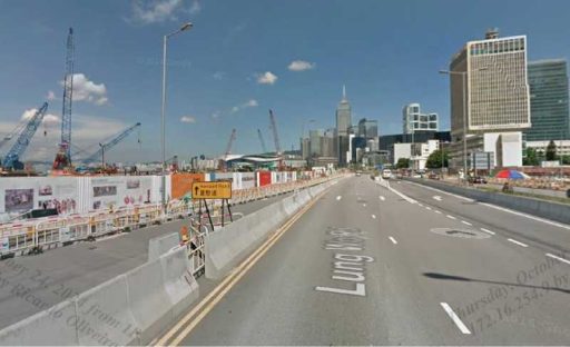
The route makes a right turn into Elegance road. (14.896443,100.400628)
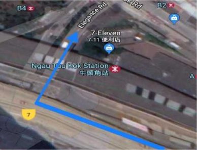
From the street imagery, we notice that right turn is not allowed.
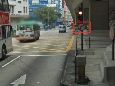
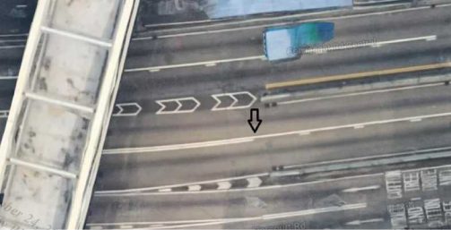
Look for the traffic sign and the arrows painted on the road.
Only straight ahead is allowed.
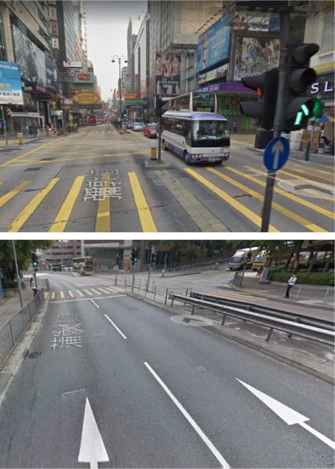
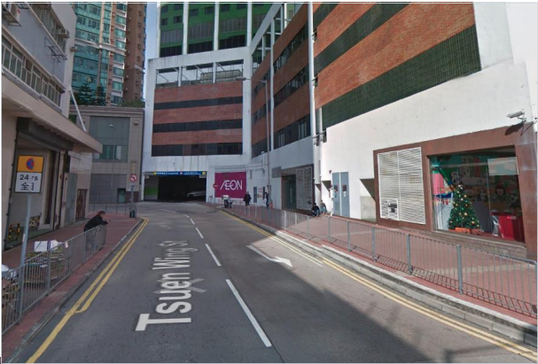
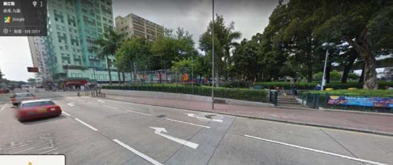
Cars on the side of the solid white line are not allowed to cross the line to the other lane, while cars on the side of the broken white line are allowed to cross to the other lane.
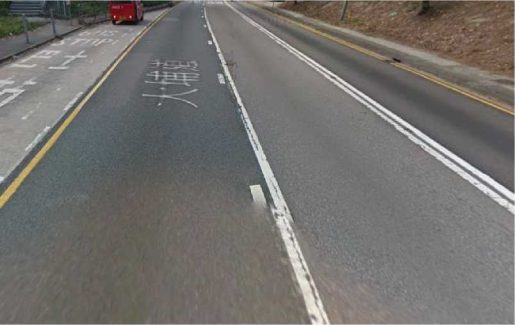
In the example above, cars can cross from left to right lane but not vice versa.

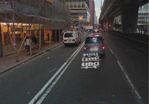
Right turn is not allowed at the point where the double white lines started.
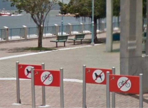
There are roads that restrict car access at all times. An example would be 渣甸坊in銅鑼灣

There are also part-time pedestrian only roads where cars are restricted to access in certain time of the day and/or certain day of the week.

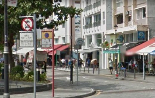
An example is 北河街 between 鴨寮街 and 汝州街 in 深水埗
The example above is 赤柱大街 in 赤柱 which restricts car access from 7pm to 11pm on Friday and 11am to 11pm on Saturday and public holidays only .
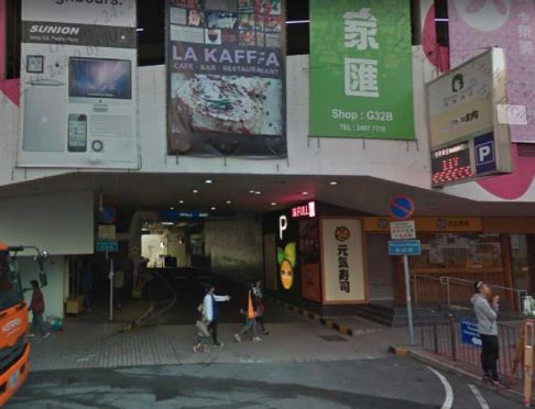
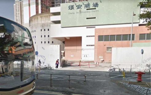
Refer to the GL 4.3.Access Restricted, If a route takes a shortcut through the parking area of a parking lot and does not end in an area associated with that parking lot, this is an Access Restricted MNE.
This route passes through a shopping mall parking lot and does not terminate in the parking lot, but get to a public road hence access restricted to be indicated.

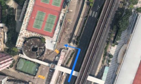
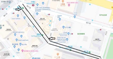
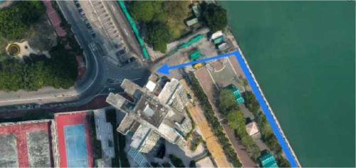
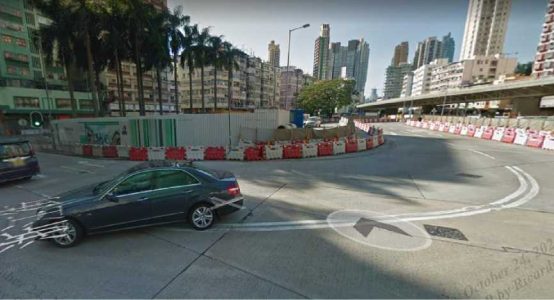
The route keeps right to Edinburgh Place from Yiu Sing Street.
From the satellite view, we can see that there are painted barriers which indicate that the turn is not allowed.
Further confirm via street imagery, there are barriers at the junction and the turn if not allowed.
Check the route using street imagery to make sure no barriers.
Note: Street imagery might sometimes be outdated and contains wrong
information. If the street imagery is too old (e.g taken several years ago), it would be a good idea to confirm with other reliable resources. You can also try to look at other street imagery near or around the area of interest to see if those are more up to date. The satellite imagery of the official government map of Hong Kong https://www.map.gov.hk/gm/ is a reliable source as it is frequently updated. The overhead satellite view is clear and detailed enough to see traffic features on the road.
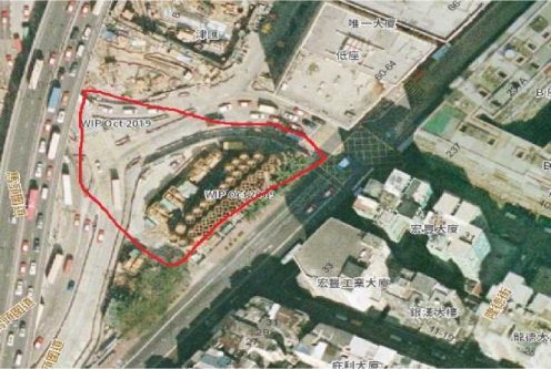
For example this image was taken in 2011 and the park is still in place.
This image was taken in Dec 2016. It shows that the park is gone and a road runs through it.
An update satellite image from HK government map shows that the park is gone
(originally red line area).
MNE | Comment |
Major Road Misalignment | On step N, -1.11111111, -2.22222222, route is missing a roundabout larger than 50m. It is considered a major misalignment and is rated as MNE. [link to resource]. On step N, -1.11111111, -2.22222222, route misses a slip lane/turn channel that measures more than 100m from its start (and/or blue line crosses it more than 50m from its starts). It is considered a major misalignment and is rated as MNE. [link to resource]. On step N, -1.11111111, -2.22222222, route is more than 50 meters misaligned with real world. Standard and Satellite views and other maps providers were checked and confirm the MNE. [link to resource]. |
Physically impossible | On step N, -1.11111111, -2.22222222, route takes user to a road that does not exist in real world. It is physically impossible. [link to resource]. On step N, -1.11111111, -2.22222222, road map has been updated and the maneuver is not possible anymore. Standard and Satellite views and other maps providers were checked and confirm the MNE. [link to resource]. On step N, -1.11111111, -2.22222222, route crosses a physical barrier, as seen on street imagery from December 2020. It is physically impossible. [link to resource]. |
Access restricted | On step N, -1.11111111, -2.22222222, user cannot access it, as it is a restricted area. The route is does not start there and it is not user’s destination, so it is marked as an MNE. [link to resource]. |
Cars not allowed | On step N, -1.11111111, -2.22222222, cars cannot access it, as it is a pedestrian area. The route is does not tells user to park the car and walk in this area, so it is marked as an MNE. [link to resource]. |
Against traffic | On step N, -1.11111111, -2.22222222, route takes user against traffic as seen on street imagery from December 2020, and traffic signs. [link to resource]. |
Illegal U-turn | On step N, -1.11111111, -2.22222222, route takes user to make an illegal U-turn. [Explain why U-turn is illegal]. [link to resource]. |
Turn | On step N, -1.11111111, -2.22222222, route takes user to make a |
restriction | right/left turn that is not allowed as seen on street imagery from December 2020 and traffic signs. [link to resource]. On step N, -1.11111111, -2.22222222, route takes user to make a right/left turn that is not allowed as seen on street imagery from December 2020, continuous yellow line indicates the turn is illegal. [link to resource]. |
Other | On step N, -1.11111111, -2.22222222, [explain with details what is wrong with the route]. [link to resource]. |