Sometimes the route seems to include physically impossible steps, but street view reveals that there is a way to perform the maneuvers in real life. Please do not rate this
as an MNE before using all available resources to confirm your decision. See the examples below and compare the satellite and street views.
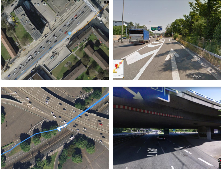
Focus on checking under bridges and other objects blocking view on satellite images; compare different maps applications to confirm if the route is valid.
A Turn Restriction MNE should be indicated when the route instructs the driver to
make a turn that is physically possible, but disallowed by signage or other restrictions. In some cases, this may be a limitation due to vehicle type (bus-only turn lanes), time of day (left turn restrictions on busy roads during rush hours) or permanent restrictions (‘no left turn’ signs). Good indicators of turn restrictions are signs/directional arrows painted on the street. Sometimes the signs/arrows are not clearly visible on satellite view or hidden by other objects, e.g. cars. Please check different maps applications and always be sure to make a thorough analysis of the ground truth. Have a look at the examples below.
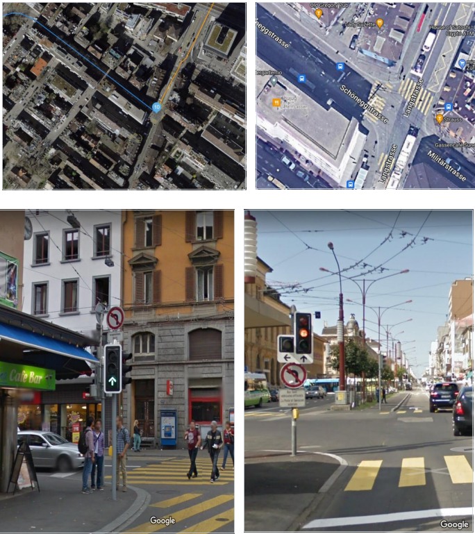
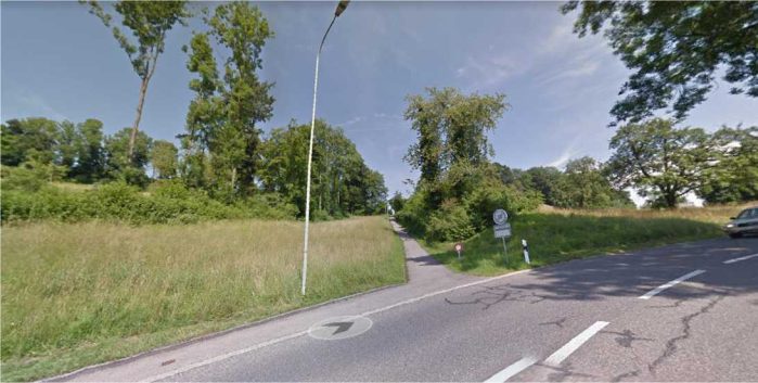
However, signs painted on the street can sometimes be confusing. Although a route might seem unsuspicious at first glance, always be sure to check the ground thoroughly.
It is possible that the arrows indicate turns that are only permitted for specific types of cars, e.g. buses (see right picture above). In Switzerland, restrictions with special lanes are common near train stations. Be very careful and always check street imagery to verify that a turn is allowed for any kind of car. Do not rely solely on painted street signs/arrows.
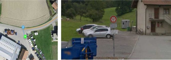
According to GL 4.3, routes whose blue route line begins or ends in a restricted access area or on a private road are assumed to have access to those roads and areas. We do not consider this an MNE.
In the example below, cars are parked in a restricted area; the route starts near the parking area. This is not an MNE.
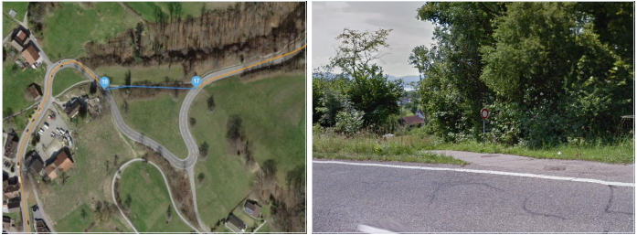
However, if a route does not start or end within a restricted access area, but uses roads to travel through such an area to reach its destination, we consider this an Access Restriction MNE because the driver would have no access to the restricted area. For more details and examples, please see GL 4.3. Access Restricted
A Cars Not Allowed error occurs when the route uses a road that does not permit the usage of a typical car. Common examples are roads or pathways that are limited to buses, motorcycles, bicycles, or pedestrians.
Using the satellite layer, we can see that this route looks suspicious and navigates through a shortcut outside the main road. To further confirm our suspicion, we can
review street imagery for this area. Doing so confirms that this is just a pedestrian pathway with no vehicular access.
If street imagery is not available or the restrictions are not very clear, it is always a good idea to check the other end of a suspicious road to determine if there is an MNE. The image below shows the exit of the suspicious part of the route. We can confirm that cars are not allowed to use this shortcut.
You can find more examples in GL 4.4 Cars Not Allowed.