1 Efficient approach to rating
Tip: Sometimes you can easily spot a problem area in a task route by requesting the same route in a different map application and quickly comparing the shapes of the routes. Investigate any obvious differences to determine whether they are caused by a Major Navigational Error in the TryRating route. If you find an MNE, you do
not need to continue checking the remainder of the route.
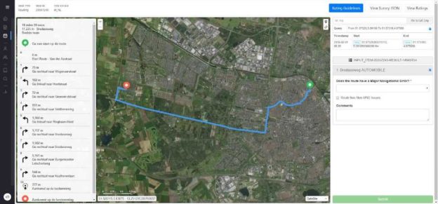
Approach rating efficiently by evaluating the route and identifying the high-risk areas. Start by evaluating these for an MNE. What are high risk areas?
Obviously, you should not rule out anything but spending time on high-risk areas, instead of tracking the route along a major road, especially rural ones, where perhaps two other map applications agree with the routing, is simply more effective way of evaluating the route.
• High risk areas need to be evaluated on a street view basis.
• Most of the other areas, especially driving along a rural road, are most of the time fine on a satellite view in combination with other map applications.
Common Mistake:
Majority of analysts rated this task as an MNE
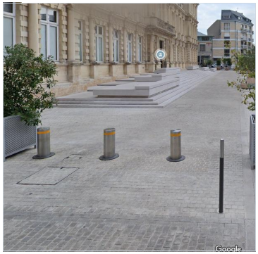
Step 12: Lat/lng 49.257761,4.031626 – blue route ends in a restricted area
Some roads are only accessible to cars at specific times of the day, carefully double check the road signs. You should base your answer on the expected time the user would arrive at a step based on the step lengths.
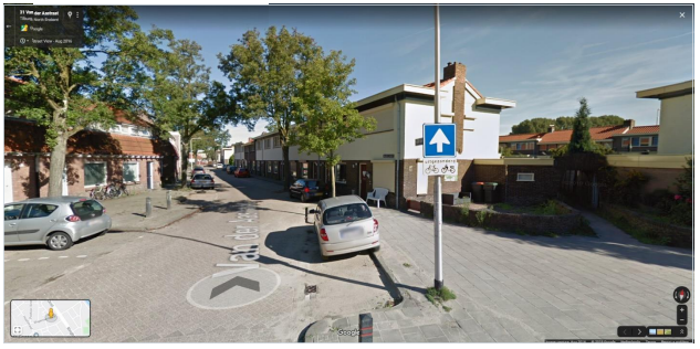
A common issue is routes starting out by going against traffic on a one way street.
In this case we can see that the route starts out on the Van der Aastraat and then directs the user to turn right onto the Wagenaarstraat. If we look at the start of the Van der Aastraat (51.572785, 5.092436) we can see that this is a one way road and that the route starts out by going against traffic.
Another relatively common issue is routes that make a turn onto a one-way road. In this example the route instructs the user to take a right turn onto the AelbrechtsKolk here (51.909688, 4.448417)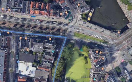 This already looks like a very narrow street. Looking at this street in street view shows that this is a one-way road and that the route is going the wrong way.
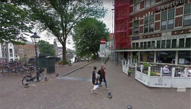 When the route illegally turns onto a one-way street, always select Against Traffic rather than Turn Restriction. See section 5.1 of the guidelines
Small paths or obstacles that let pedestrians and cyclists through, but are designed to block cars are common. These can be hard to spot in the satellite layer.
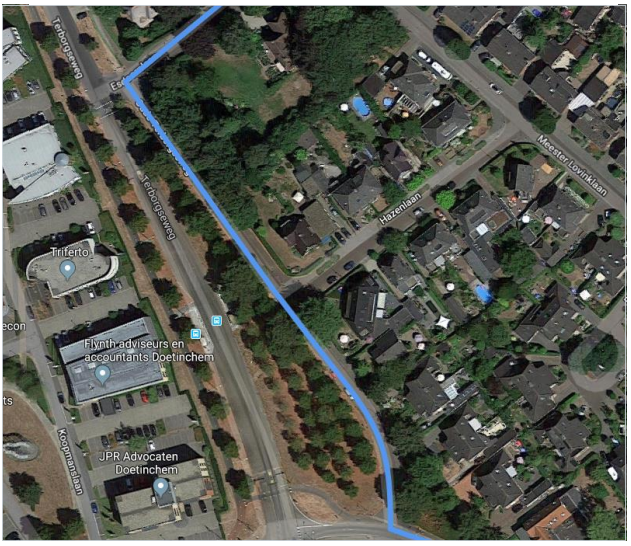
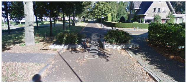
In this example the route instructs the user to follow the Oude Terborgeseweg in Doetinchem here (51.952261, 6.305208)
It does not look like anything special from above, but if we look at this road in street view we can see an obstacle that does not allow cars through.
It can help to look for signs that indicate that there might be a dead end, as seen here at the start of this road.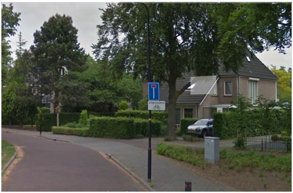 Illegal U-turnA user can be instructed to perform a U-turn when it is not allowed. When approaching an intersection, drivers have to follow the direction of the sorting lane they are in. Drivers can be instructed to make a U-turn in a direction that isn’t allowed.In this example the driver is instructed to make a U-turn by taking a left turn on this intersection here (51.962838, 6.288264).
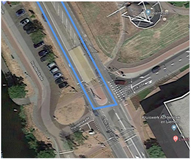 Drivers approaching this intersection from the north are only allowed to turn right or to continue straight. Making this U-turn here would be illegal.
 6 Cars Not Allowed1.1Bicycle lanesThere are many bicycle lanes in the Netherlands, many of which are separate from the roadway. Some of these can look like regular roads from above. It is not uncommon that the blue line suggests that the user should drive onto a bike lane.In this example the route follows the Haagbeukweg north and then instructs the driver to turn left onto the Spoorbaanpad here (52.376372, 5.242788)
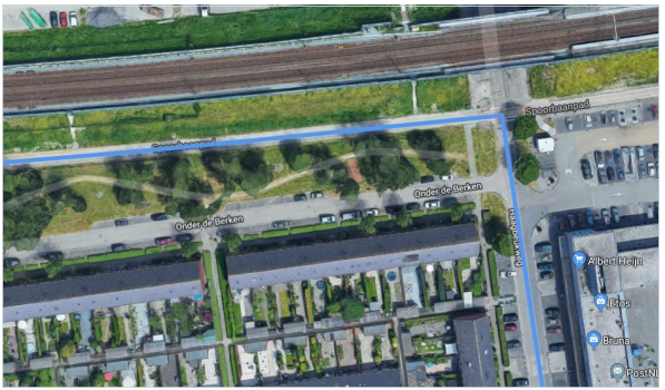 If we look at this road in street view, we can see that this isn’t a road at all. This is a bicycle lane where cars aren’t allowed.
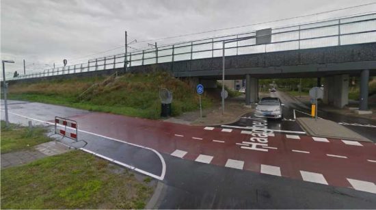 Things to look out for to spot bicycle lanes are roads that look narrow and roads that appear to run parallel to other roads. Often bicycle lanes are colored red as well.
‘o
Like bicycle lanes, pedestrian only areas are also common in the Netherlands. These are especially common around city centers. These pedestrian only areas might also look like roads from above.
Here the route follows the Hagenstraat and then instructs the driver to enter the Varkensmarkt (51.988555, 6.567562).
This looks like it could be a road, but if we look at this area in street view we can see that this is a pedestrian only area where
cars aren’t allowed.
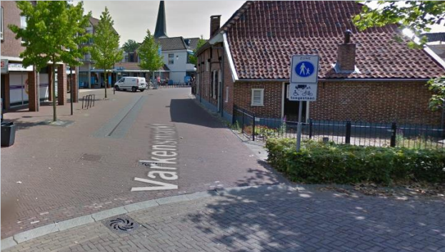
Pedestrian only areas are not considered Access Restricted zone so even if the blue lines begins or ends in the pedestrian only areas, it would still be considered MNE.
Roads are always changing and maps aren’t always up to date. The blue line can often appear to be misaligned because satellite images are dated. It’s important to do research to find out the actual layout of the road.
Here (52.47427,5.490254) the blue line appears to instruct the driver to cross a non lane space to exit the highway.
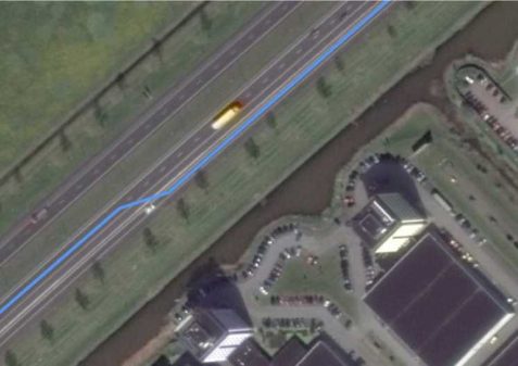
If we look at more recent images in Google Maps, it becomes clear that this road has changed and there is now an off-ramp that starts around this location. The route actually follows the ground truth. In street view we can also compare old images with more recent images. Here we can see the changes that were made to this road.
 8 Parking Instructions
Some routes include instructions for the user to park their car. This usually occurs when the route continues in areas where cars are not allowed, or parts where cars can’t physically go. The route should not be considered to have a Cars not Allowed MNE after this step.Do not consider if a user is legally allowed to park their car at the step where “Prepare to park your car” is indicated. This guidance is not intended to indicate a specific parking spot, but rather that the user will need to park and proceed on foot from this point on.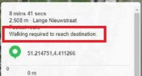
 9 Comments
When the route has a Major Issue, you are required to indicate which step the MNE was found. Here are some examples of good comments:
MNE | Comment |
Major Road Misalignment | On step N, -1.11111111,-2.22222222, route is missing a roundabout larger than 50m. It is considered a major misalignment and is rated as MNE. [link to resource]. On step N, -1.11111111,-2.22222222, route misses a slip lane/turn channel that measures more than 100m from its start (and/or blue line crosses it more than 50m from its starts). It is considered a major misalignment and is rated as MNE. [link to resource]. On step N, -1.11111111,-2.22222222, route is more than 50 meters misaligned with real world. Standard and Satellite views and other maps providers were |
| checked and confirm the MNE. [link to resource] |
Physically Impossible | On step N, -1.11111111,-2.22222222, route takes user to a road that does not exist in real world. It is physically impossible. [link to resource]. On step N, -1.11111111,-2.22222222, road map has been updated and the maneuver is not possible anymore. Standard and Satellite views and other maps providers were checked and confirm the MNE. [link to resource]. On step N, -1.11111111,-2.22222222, route crosses a physical barrier, as seen on street imagery from December 2020. It is physically impossible. [link to resource]. |
Access Restricted | On step N, -1.11111111,-2.22222222, user cannot access it, as it is a restricted area. The route is does not start there and it is not user’s destination, so it is marked as an MNE. [link to resource]. |
Cars not Allowed | On step N, -1.11111111,-2.22222222, cars cannot access it, as it is a pedestrian area. The route is does not tells user to park the car and walk in this area, so it is marked as an MNE. [link to resource]. |
Against Traffic | On step N, -1.11111111,-2.22222222, route takes user against traffic as seen on street imagery from December 2020, and traffic signs. [link to resource]. |
Illegal U-turn | On step N, -1.11111111,-2.22222222, route takes user to make an illegal U- turn. [Explain why U-turn is illegal]. [link to resource]. |
Turn Restriction | On step N, -1.11111111,-2.22222222, route takes user to make a right/left turn that is not allowed as seen on street imagery from December 2020 and traffic signs. [link to resource]. On step N, -1.11111111,-2.22222222, route takes user to make a right/left turn that is not allowed as seen on street imagery from December 2020, continuous yellow line indicates the turn is illegal. [link to resource]. |
Other | On step N, -1.11111111,-2.22222222, [explain with details what is wrong with the route]. [link to resource]. |