Pin Rating & Street Imagery: Best Practices
To assign the correct Pin rating, one must use different functions within different applications:
Note: use only the map layers in TryRating to identify whether the Pin is falling on the rooftop, or if it is slightly off. (Section 9.1.1)
Use different sources to identify whether the building in question is actually the right one. Also rely on additional sources to determine whether a rating should be Next Door or Wrong.
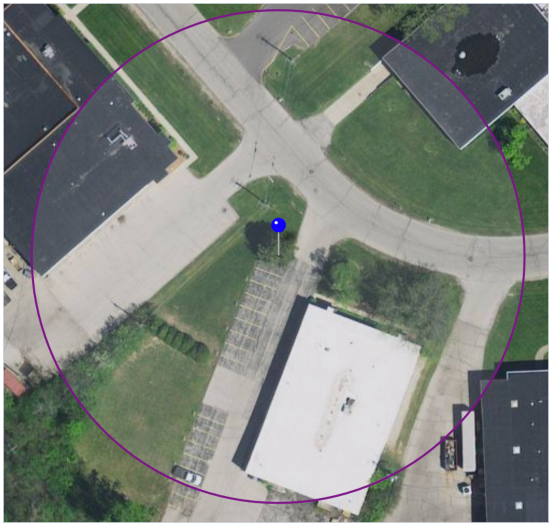
Example 1: You have confirmed through street imagery that the Pin falls on the right property. Use only the map layers in TryRating to determine if the correct rating is Perfect or Approximate. We can see in the TryRating screen shot below that the Pin falls on the grass in the shade of the building in question. The Pin does not fall on the rooftop. The correct rating is therefore Approximate. We do not check other map applications to see if the Pin falls on the rooftop, or not.
To identify the correct building, use different map applications and street imagery.
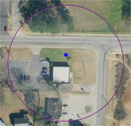
Example 2: The TryRating screen shot below shows that the Pin is falling on the property of a building, not on the rooftop. We therefore know that the Pin rating can’t be Perfect, but we don’t know if it’s Approximate, Next Door, or Wrong. We need to first find out if the property belongs to the result address, or a different address.
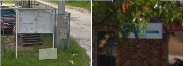
Using street imagery, we can see that the street number of the property where the Pin falls is 6990, while the result address is confirmed to be 7080.
Because the Pin doesn’t fall on the right property, the Pin rating can’t be Approximate.
To determine whether the correct rating is Next Door, or Wrong, we need to determine where the correct building is. With street imagery, we can tell that the correct property is several addresses down the road, which is why the correct Pin rating is Wrong.
Street Imagery becomes particularly important where we have multiple businesses under one roof. In most cases, we can find some street imagery (street view, customer photos, etc.) that allows us to figure out where the pin should fall.
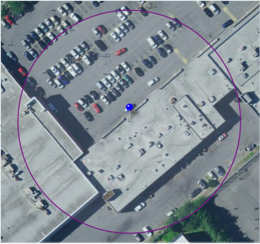
Example 3: In the TryRating screen shot below, we can see that the Pin falls on the rooftop of a shopping mall. We use street imagery and other strong evidence to determine the exact location of where the Pin should fall.
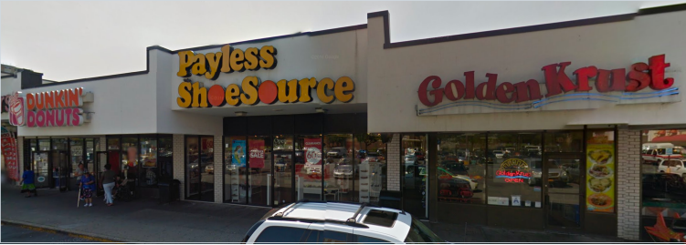
The below screen shot shows that our Pin falls on the Golden Krust, while the result is Dunkin’ Donuts. The result is therefore not Perfect. Following the “One building with multiple street numbers in a shared parking lot” example in Section 9.2 in the Search GL, “the rest of the connected rooftop […] is considered Approximate”. The correct Pin rating for this scenario is Approximate.
Remember: Make no Next Door ratings outside the parcel or shared space. Any Pin falling outside of the Approximate area in a shared Space will be rated Wrong.
• It can be difficult to find house numbers sometimes – take a close look!
(http://bit.ly/2DcRKWK) – use the clock icon to browse historic imagery
Please note that the above examples feature Single Rooftop scenarios.
Special rules apply for special features like campuses, natural features, transit POIs etc. Please see Section 9 of the Search Guidelines for more information