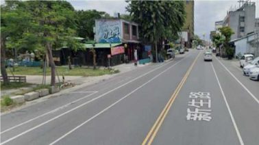
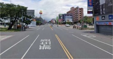
Continuous yellow line on the road indicates that the turn is not allowed; if the yellow line is discontinuous on the road intersection, the turn is allowed.
There are many kinds of illegal turn signs in the cities, please pay attention to the annotations.
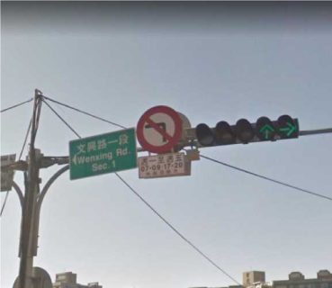
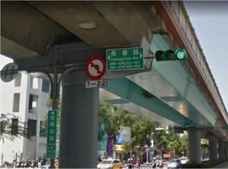
In this example, the illegal left turn is only for rush hour 07-09, 17-20 on weekdays. It is not an illegal turn if the routing timestamp is on the weekends and public holidays.
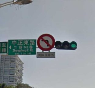
In this example, the illegal left turn restriction is for all day on weekdays, but no restriction on weekends and public holidays.
Tip: If the traffic signs have certain time limit, you can evaluate the timestamp on the
rating tool.
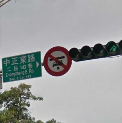
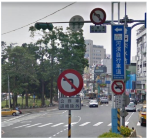
In this example, the turn restriction is for trucks only. Our routing task is for regular cars, this kind of traffic signs shall be ignored.

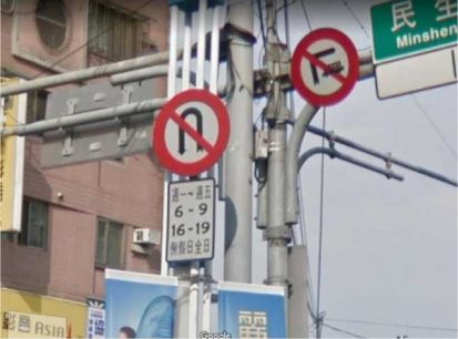
Some illegal U-turn signs indicate certain days of the week. In this example, it is for 6-9, 16-19 on weekdays, but all day on weekends and public holiday.
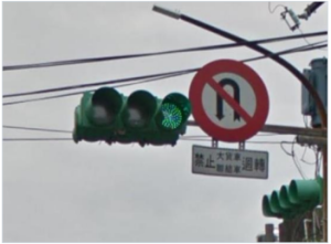
According to Taiwan traffic regulation, illegal left traffic sign also indicates illegal U-turn.
The time restriction on the illegal left sign is also applied with illegal U-turn.
In this example, official vehicles are allowed to make a U turn as per traffic sign annotation. Since our routing task is for regular cars, this kind of traffic sign annotations shall be ignored. As always, it is important to evaluate street image to understand real world ground condition, particularly when the route is travelling through city area.
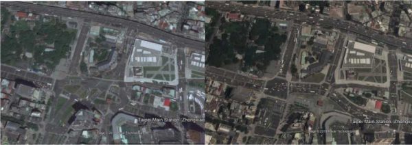
Road condition is changing constantly, because the city is growing, so the analyst shall evaluate multiple satellite map providers and the latest street image to make correct rating.
Previous Current
Routes often will take the user where there are no real road. Analysts need to investigate with street image, satellite view and other map providers if the road actually exist.
3.3 Road doesn’t exist in real world
Sometimes the route navigates through roads that look okay on the satellite map and standard map, but it is actually a pedestrian pavement that have stairs.
A lane may look like a normal street on the satellite map, but there is actually a physical barrier. Remember that the “cars not allowed” option is mostly reserved for where cars can physically enter the location, but is not allowed.
Sometimes the route makes a shortcut that is actually too narrow for a car, it shall be rated as physical impossible not car not allowed.
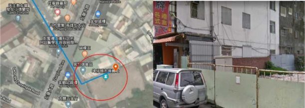
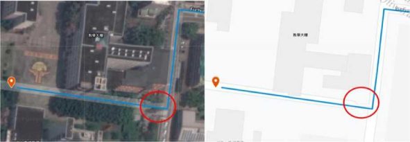
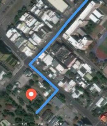
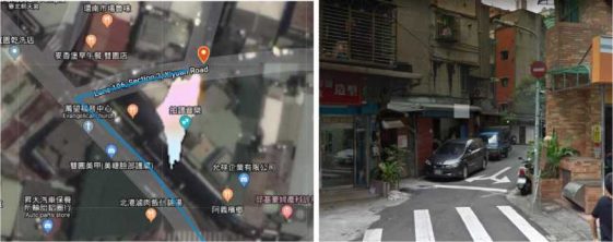
In this example, the route is already suspicious, since there is no visible lane/alley on the satellite image.
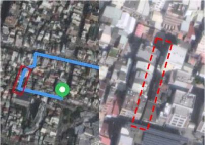
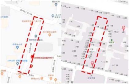
The alley looks like a regular road on Google standard map, and there is a street name assigned with it. However, the road doesn’t look like a regular road on Taiwan Map Service.
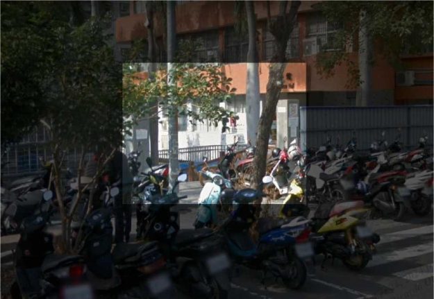
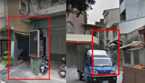
Take a close look on street image, the latest street image (2017) doesn’t have an appropriate angle to evaluate the road width. There is also not a good view on the other side of the alley.
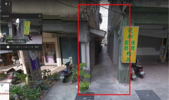
However, the alley width can be evaluated via older street images, which gives much better angle for this particular alley. At this point, it becomes quite clear, the alley is impossible to travelling by cars.
Tip: If it is not entirely sure whether a car can physically pass through, try checking all possible entryways into this lane, if it is clear that cars can enter from the other side, it most likely can exit from this side.
Some routes may look like misaligned on Satellite map, or the route may look like unsafe to drive. As long as they are not 50m away from the intended road, they are not MNE.
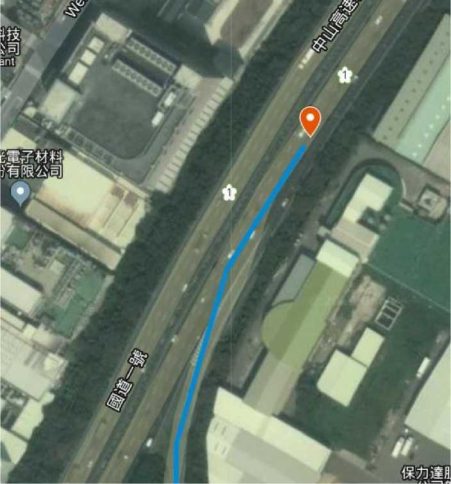
The route entered the expressway too early, however, the misalignment is within 50m, it is not a MNE.
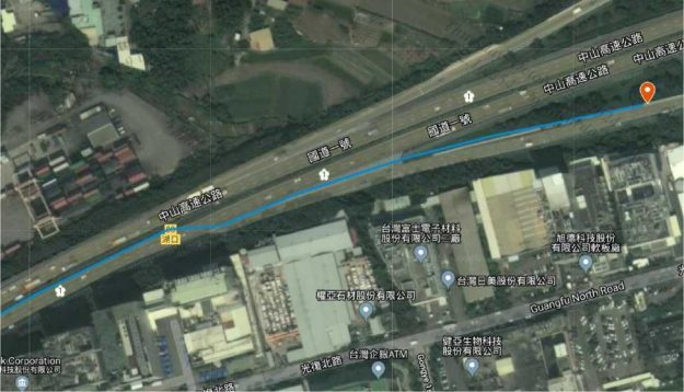
The route looks like not leaving the expressway properly, however, the route makes a turn before the non-lane area, the small misalignment is not a MNE.
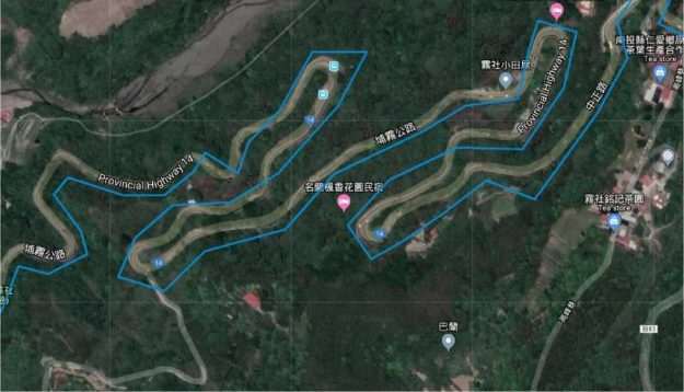
The route may look like a serious misalignment in the mountain area, but the misalignment is within 50m, it is not a MNE.
There are many one way roads in the cities, particularly in the residential area, analysts shall always pay extra attention to these areas.
Example of a good comments:
MNE | Comment |
Major Road Misalignment | On step 1, 1.111111, 2.233333, route is missing a roundabout larger than 50m. [link to resources]. On step 3, 1.111111, 2.233333, route misses a slip lane/turn channel that measures more than 100m from its start(and/or blue line crosses it more than 50m from its starts). [link to resource] On step 12, 1.111111, 2.233333, route is more than 50 meters misaligned with real world. Standard and satellite views and other map providers were checked and confirm the MME. [link to resource] |
Physically impossible | On step 1, 1.111111, 2.233333, route takes the user to a road that does not exist in real world. [link to resource] On step 1, 1.111111, 2.233333, road map has been updated and the maneuver is not possible anymore. [link to resource] On step 1, 1.111111, 2.233333, route crosses a physical barrier, as seen on street imagery from December 2019. [link to resource] |
Access restricted | On step 1, 1.111111, 2.233333, user cannot access it, as it is a restricted area. The route doesn’t start there and it is not user’s destination. [link to resource] |
Car not allowed | On step 1, 1.111111, 2.233333, cars cannot access it, as it is a pedestrian area. The route doesn’t tell users to park the car and walk in this area, so it is marked as a MNE. [link to resource] |
Against traffic | On step 1, 1.111111, 2.233333, route takes user against traffic as seen on street imagery from December 2019, and traffic sign. [link to resource] |
Illegal U-turn | On step 1, 1.111111, 2.233333, route takes user to make an illegal U-turn. [explain why U-turn is illegal]. [link to resource] |
Turn restriction | On step 1, 1.111111, 2.233333, route takes user to make a right/left turn that is not allowed as seen on street imagery from December 2019 and traffic sign. [link to resource] On step 1, 1.111111, 2.233333, route takes user to make a right/left turn that is not allowed as seen on street imagery from December 2019, continuous yellow line indicates the turn is illegal. [link to resource] |
Other | On step 1, 1.111111, 2.233333, [explain with details what is wrong with the route]. [link to resource] |
6.2Non-MNE Comment
When a Non-MNE is found, leave a comment that includes: